Home  Download documents Research theme 1: Study site contexts & goals WP1.2 Assessment and mapping
WP1.2 Assessment and mapping
Documents and reports relating to WP1.2 Assessment and mapping.
Documents
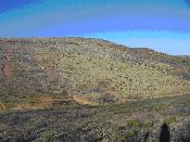
 Are the DESIRE sites browning or greening?
hot!
Trends in NDVI/NPP were determined for the DESIRE study sites. Author: Zhanguo Bai. March 2011
Compilation & synthesis of study site descriptions
hot!
Compilation of all study site descriptions. Author Godert van Lynden. March 2011
Extent of degradation and conservation
hot!
Description of the two parallel and complementary methods used to map the extent of desertification and restoration measures in the study areas. Authors: Godert van Lynden, Stephan Mantel, Rudi Hessel
Mapping land degradation and SLM (QM)_Arabic
hot!
Editors: Hanspeter Liniger, Godert van Lynden, Freddy Nachtergaele, Gudrun Schwilch ©2008: CDE/WOCAT, FAO/LADA, ISRIC
WOCAT method for mapping land degradation and sustainable land management [Arabic]
Mapping land degradation and SLM (QM)
hot!
Editors: Hanspeter Liniger, Godert van Lynden, Freddy Nachtergaele, Gudrun Schwilch ©2008: CDE/WOCAT, FAO/LADA, ISRIC
WOCAT method for mapping land degradation and sustainable land management [English]
 Assessment and mapping methodology
hot!
A methodology for obtaining a picture of the distribution and characteristics of land degradation and conservation activities for a district, province, country, region or ultimately world-wide. The final output is maps of land degradation status, causes and impacts and the conservation status and impacts for major land use systems in the area.
Acknowledgement
The DESIRE project was
|
DESIRE brought together the expertise of
26 international research institutes
and non-governmental organisations.
This website does not necessarily
represent the opinion of the
European Commission. The European
Commission is not responsible for
any use that might be made of the
information contained herein.