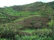
Images used in the Sehoul, Morocco study site description.
|
Simulated landscape |
Image of Sehoul commune |
Location of the study site |
Slope map of the Sehoul commune |
|
Longitudional profile |
Geological map of the Sehoul commune |
Soils map |
Annual rainfall |
|
Monthly rainfall |
Distribution of forests |
Effects of runoff |
Runoff |
|
Suspended load |
Soil loss |

Acknowledgement
The DESIRE project was
|
DESIRE brought together the expertise of
26 international research institutes
and non-governmental organisations.
This website does not necessarily
represent the opinion of the
European Commission. The European
Commission is not responsible for
any use that might be made of the
information contained herein. 


