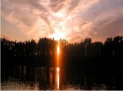
General images from the Zeuss-Koutine Study Site (© Mohamed Ouessar, Institut des Régions Arides, Médenine, Tunisia)
|
Study site location |
Detail study site location |
Soil map |
Land use map |
|
Jessour system |
Wadi Nkim |
Grazing livestock |
WB1 mapping method #2 |
|
WB1 mapping method |
WB2 field work |
WB2 field work #2 |
Roman dam, near Koutine village |
|
Gullies on hillslope |
Degraded ranglands in the Dhahar plateau |
Jessour system in loess deposits near Béni Khédach |
Damage of jessour dykes can cause water erosion |
|
Mountain watershed treated with cascading jessour |
Local tabias system in the piedmont area |
Collection of runoff by water harvesting |
Groundwater recharge well |
|
Gabion check dam on the main wadi |
Damage to gabion check dams by flooding (Feb07) |
Consolidation of water harvesing works with cactus |
Overgrazing and sand encroachment at water point |
|
Irrigation field in the Jeffara plain |
Livestock in the mountain grazing lands |
Spreading floodwater |
Runoff storage cistern (majen or fasquia) |
|
WP3.1 Stakeholder Workshop 1: results poster |

Acknowledgement
The DESIRE project was
|
DESIRE brought together the expertise of
26 international research institutes
and non-governmental organisations.
This website does not necessarily
represent the opinion of the
European Commission. The European
Commission is not responsible for
any use that might be made of the
information contained herein. 


