Topography
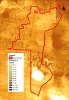
The North-Western part of Caspian Lowland where Pallasovsky District is located, is a plain, slightly inclined toward the Caspian Sea with a maximal elevation of about 67 m asl at Ulagan salty hill and Presny Liman hill about 56 m asl. Its minimal elevation is about -17 m at the Elton Lake bed (Fig. 3), which maximum depth is about 0.5 m. This territory is poorly drained, mainly by two small rivers networks. The first one in the northern part with fresh water is linked to the Torgun River which is a tributary of Volga River, the second one in the southern part with saline water (5 - 25 g/l) is linked to Elton lake. The central part doesn't have any distinct surface water network, but has a well-pronounced meso- and micro-relief, which has a big impact on local runoff and infiltration.
 |
 |
 |
 |
Fig. 3: Regional elevation map, derived from Global mapping |
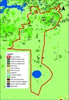
Fig. 4: Regional Land Cover map, derived from Global mapping |
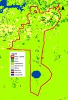
Fig. 5: Regional Land Use map, derived from Global mapping |
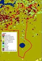
Fig. 6: Regional Vegetation map, derived from Global mapping |