Bio-physical description

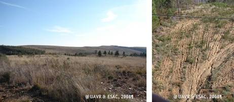
Figure 2 - Landscape (right) & soil erosion in Mação Municipality (left)
Mação lies in a transition zone between the Atlantic and the Mediterranean climate types, and is located on the northern bank of the lower Tejo River, central Portugal. In a 20 km north-south transect, rainfall varies from 1000 mm to less than 600 mm per year. The climate is characterized by long, hot and dry summers and wet autumns, winters and springs. There have been several drought years recently. The soils are typically very shallow and stony Humic Cambisols, in some places less than 20 cm deep as a result of long-term soil erosion processes (Figure 2). Major hazards arise from poor agricultural and forestry practices, such as plough ridges and furrows being aligned transverse rather than parallel to the contour, and from frequent forest fires.

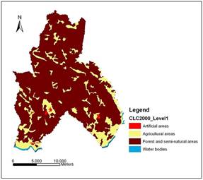
Figure 3 - Land Use Map of Mação Municipality (CORINE 2000)
At the beginning of the 20th century, Mação municipality had a highly diversified landscape supporting a variety of activities including subsistence farming, grazing of sheep and goats and forestry (for timber production and resin extraction). In the 1950s and 1960s, large-scale migration to Lisbon led to major changes in land use. The area under pasture and agriculture decreased and was replaced by shrubs and forest (Figure 3), which was characterized by Pinus pinaster until the mid 1980s, and then by Eucalyptus globulus.
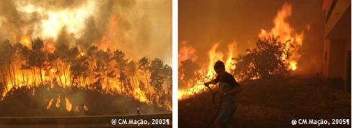
Degraded areas of shrubland and pine regrowth developed as a result of forest fires. More than 80% of the area of the municipality was burnt in the 2003 and 2005 summer fires (Fig 4).
In recent years, several policies have been devised and implemented to promote soil conservation and improve agricultural and silvicultural sectors, at European and national levels. Several projects have recently been implemented, focusing particularly on afforestation of part of the burned areas.

Figure 4 - Forest fires in Mação Municipality
Results from previous projects show a wide range of soil erosion rates and overland flow amounts for the various land uses, with some conservational land uses such as mature pine plantations, and eucalyptus plantations on terraces on steep slopes rather than eucalyptus seedlings being planted on rip-ploughed land with plough ridges and furrows aligned transverse to the contour. Other forestry management practices lead to soil losses typically at least forty times higher and overland flow amounts considerably higher compared with these conservational practices. Amongst the land uses with high risks are those resulting directly or indirectly from human activity, such as the practice of ploughing the land and destruction of the vegetation by wildfires which gives rise to a 'window of disturbance' during which there can be substantial soil losses before a vegetation cover that includes pine seedlings can provide protection for the bare soil.

Figure 5 - Some conservation measures applied in Mação Municipality (2003)