General information
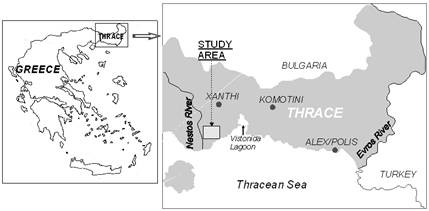
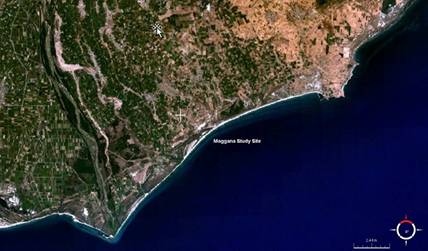
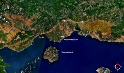
The Maggana study site is situated in North Greece (Thrace region). It covers an area of approximately 50 km▓ which extends to the alluvial deposits of the east Nestos river delta adjacent to the river and the coastline of Thracean Sea (Figure 1). The coordinates of central point of the study site are Latitude: 40║ 54' 57.93" N and Longitude: 24║ 51' 11.87" E (Figure 2). The morphology of the region is plain and it is characterised by a very low relief and shallow pits, the latter being localized to the S and SE, forming small ponds, which are part of the eastern Nestos delta wetlands. The most important land degradation process affecting this area is soil salinization. The main reason for soil degradation is the excessive use of saline water resources for irrigation.

Figure 1: Location of the Nestos River Delta study site, Maggana

Figure 2: Nestos River Delta, Maggana Study Site Landscape (NASA 2008)

Figure 3: Location of Nestos River Delta, Maggana study site (NASA 2008).
During the decades of the 1950s and '60s, a variety of flood-controlling engineering works have been constructed, in the framework of conceived wetlands management system. These works included river diversion, caisson, modification, draining of wetlands and construction of drainage canals. These interventions have been carried out without any provision for the induced changes in the ecological balance and the interruption of groundwater recharge regime. With the progressive implementation of land improvements, the arable area was protected from the floods and significantly expanded. Furthermore, the expansion of the cultivated land required additional quantities of irrigation water, in local scale, and a large number of groundwater wells were installed. Thus, the groundwater table declined during the following years and seawater intruded into the coastal aquifers up to several kilometres inland.