Data collection
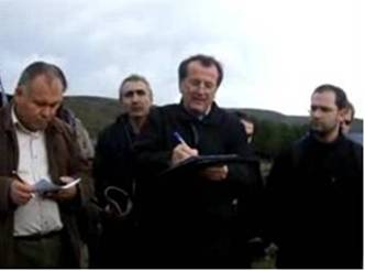
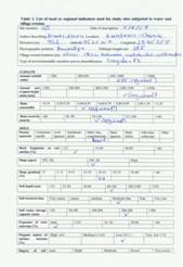
Αfter defining the list of indicators (Tables 1 and 2), questionnaires have been prepared including all the indicators corresponding to the identified process or cause important for each study field site. Furthermore, a manual for "Describing Land Degradation Indicators" has been prepared and distributed to all study sites to be used for conducting field survey collecting the data for the identified indicators. A presentation from the leading partner of WB2 has been organized in the field trip of Eskisehir Plain (Turkey) study site in which the details of how to fill the defined questionnaires has been explained (Fig. 1).


Fig.1. Explaining in the DESIRE study site groups how to fill the questionnaires of the defined indicators
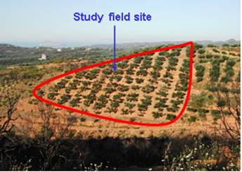
As field site has been considered a farm belonging to a certain farmer with an area usually ranging from 0.5 to 20 ha and having uniform soil, topographic, land use, and land management characteristics (Fig. 2). Furthermore, the farm survey was conducted for each process and land use types such as olive groves, vineyards, cereals, almonds, cotton, pastures, oak forests, pine forests, etc., representative of Mediterranean environmental conditions, and a minimum number of 30 questionnaires were filled in most of the cases.
The field sites have been located on topographic maps or ortho-photo maps in grids of 400 meters by 400 meters applying a systematic sampling design. Some of the field sites were studied by using this sampling technique. However, this approach was not easily applied since the presence of land owner was necessary for the collection of some data related to land management and social characteristics. Therefore, the majority of the described field sites were located on fields where the farmer was found on his land. The location of each field site was accurately defined using a GPS. The datasets collected for the various indicators have been included in the Harmonized Database System (HIS) which is developed in WB6.

Fig. 2. Example of study field site with certain soil, topography, land use, and land management characteristics belonging to a certain farmer
In order to make an interdisciplinary approach for defining desertification risk and assessing the effectiveness of various land management practices for combating desertification, data for the selected indicators have been collected from a variety of land uses, climatic conditions, soil and topographic characteristics, social and economical characteristics. Data on indicators were collected from 17 study sites located in various areas sensitive to desertification. The physical, social, and economical characteristics and their exact location are given in WB1. More specifically, data were collected from the following study sites located along the Mediterranean Europe, Eastern Europe, Africa, Asia, and Latin America:
- Rendina Basin Basilicata-Italy
- Nestos Basin Maggana-Greece
- Crete-Greece
- Mação- Portugal
- Gois - Portugal
- Guadalentin Basin Murcia-Spain
- Konya Karapinar plain-Turkey
- Eskisehir Plain, Turkey
- Novij Saratov-Russia
- Djanybek-Russia
- Zeuss Koutine-Tunisia
- Boteti Area-Botswana
- Santiago Island-Cape Verde
- Mamora Sehoul-Morocco
- Loess Plateau-China
- Secano Interior-Chile
- Cointzio catchment-Mexico