|
Database of indicators in study sites |
 |
|


|
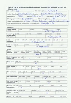
All the results from the field inventory from the 1641 locations are combined in an excel database.
- The database contains separate worksheets for the different desertification processes (soil erosion (by water, tillage wind); soil salinization; water stress; forest fires; urbanization; overgrazing).
- On each sheet, the columns list the indicators that are relevant for that particular desertification process.
- The values given for all the indicators correspond to the coding that is given in the Database of study site indicators (introduction).
- Data from the different study sites are given in separate blocks, one below the other.
|
Conclusions
By and large, the indicators, classes and class boundries that were suggested were also found to be applicable also to locales outside the European Mediterranean area. However in a few cases, some difficulties were encountered.
 |
- The classes of indicator parent material were applicable almost in all study sites except Zeuss-Koutine in Tunisia, where gypsum could not be classified in the specified class ranges.
- The indicator describing the major land uses needed additional class ranges to describe the orchards, settlements and military areas found in Yan River Basin, China, Karapinar, Turkey, Boteti, Botswana and Góis, Portugal.
- Other indicators that should probably be consisted of expanded class ranges are vegetation cover type, farm ownership, parallel employment, tillage operations and grazing control.
|
However, such difficulties do not preclude the meaningful analysis of the indicators that is carried out in »WP2.2 Evaluation and short-list of indicators. Based on this analysis, some recommendations are made for changes in the indicator questionnaire that may make the method more easily applicable to areas outside the European Mediterranean area.
|


