Home 2. Assessment with indicators Identifying indicators

Identifying indicators
Stage 1 in the process of linking desertification and land degradation indicators to land use practices


»Manual for describing land degradation indicators The manual contains definitions of 69 indicators of desertification and land degradation that have been developed in past and on-going research programmes. It also contains data recording sheets for use at the local and regional scale and extensive explanation notes for collecting indicator data in the field. This list of indicators is suitable for use in most semi-arid environments, although some adjustment of the classification thresholds may be necessary for non-European Mediterranean sites.
»Indicators in the study sites Data on 72 land degradation indicators have been collected from 1641 locations across all 17 DESIRE study sites. This report contains a summary of the data collected and gives an excellent overview of the range of bio-physical, land use and socio-economic conditions that occur across the study sites.
»Database of indicators in the study sites The database contains separate worksheets for each desertification process. For each process the relevant indicators are listed along with their recorded values in all the field locations.


# Article Title
1 Manual for describing land degradation indicators
2 Indicators in the study sites
3 Database of indicators in study sites
 
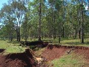
Calabozo_erosion_debajo_bosque_eucalipto_211008_.jpg.jpg

Acknowledgement

fp6 logo 3 50 x 43
The DESIRE project was 
co-funded by the
European Commission,
Global Change and
Ecosystem.
DESIRE brought together the expertise of
26 international research institutes
and non-governmental organisations.
This website does not necessarily
represent the opinion of the
European Commission. The European
Commission is not responsible for
any use that might be made of the
information contained herein.

Follow us