 |
The DESIRE project aims to establish promising alternative land use and management conservation strategies in sixteen degradation and desertification hotspots around the world, based on a close collaboration of scientists with local stakeholder groups. This integrative participatory approach ensures the acceptability and feasibility of conservation techniques, as well as a sound scientific basis for the effectiveness at various scales. DESIRE employs a bottom up approach.
|
- degradation and desertification hotspots and stakeholder groups have been identified in all countries surrounding the Mediterranean, and in 6 external nations facing similar environmental problems,
- desertification indicator sets will be defined in a participatory approach and a harmonized information system will be constructed to organize socio-economic and geo-information data,
- new and existing conservation strategies will be defined with the stakeholder communities;
- these strategies will be implemented in the field, and monitored and modeled to quantify their effectiveness at various scales,
- the results will be extrapolated using indicator sets, geo-information data, and integrated modeling systems combining socio-economic and environmental aspects, and
- finally the results will be translated to a series of practical guidelines for good agricultural practices and environmental management, which will be disseminated to practitioners, agricultural extensionists, governmental authorities, policy makers, NGOs, land users, land owners, and local communities.
|
 |
 |
 |
|
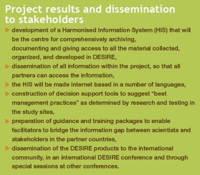
In order to achieve the goals mentioned in the introduction, the DESIRE IP has been divided into a logical series of interrelated Working Blocks (see figure below), each with specific goals, tasks and deliverables.
|
- WB1 inventorizes the 18 hotspot target areas and organizes both spatial environmental data and socio-economic data of stakeholder groups.
- WB2 uses this information and available results from other EU projects to define and evaluate sets of desertification indicators. These indicators are tested for their efficiency in the monitoring phase in WB4 and used to organize the monitoring results into a framework.
- WB3 uses the information of WBs 1 and 2 to develop a series of conservation and remediation strategies in close cooperation with the stakeholders.
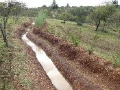
- These strategies are implemented in each of the hotspot areas in WB4 and their efficiency is measured and modeled over the course of several years.
- The goal of WB5 is to upscale the results of WB4 and model them on a larger scale, forecasting regional effects of combating desertification both in environmental and socio-economical terms.
- WB6 finally runs parallel to the other workblocks in that it designs a harmonized data information system to which all WBs contribute data, and organizes the dissemination of the results.
|
|
|
 |
 |
|
A global research initiative to mitigate desertification and remediate degraded land.
|
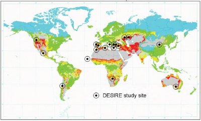
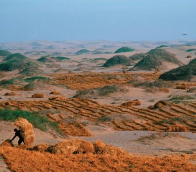
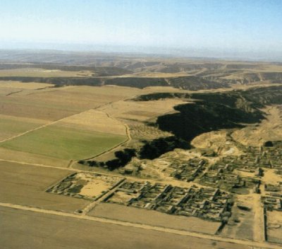
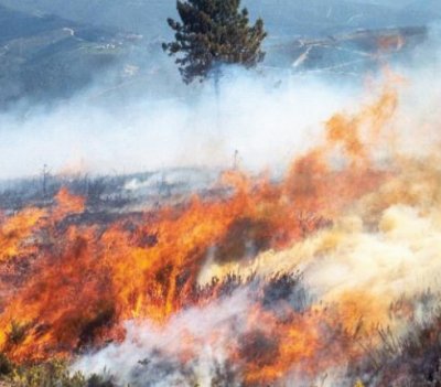
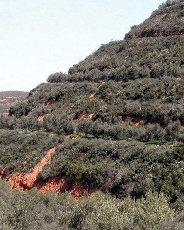
The DESIRE project encompasses a set of 18 study sites around the globe (see Figure below) that are affected by one or more desertification related problems. These areas have a different socio-economic context in the form of land use and management, and a different physical context in the form of climate and landscape. This gives DESIRE a truly global "laboratory" to apply both tested conservation and remediation measures, and find new and innovative approaches to combat desertification. One of the main challenges will be to merge the results into a methodological framework and harmonized database information system. This calls for a well structured approach.
|
|
Desertification Vulnerability |
Study site area
|
Main Problem/ Desertification process |
|
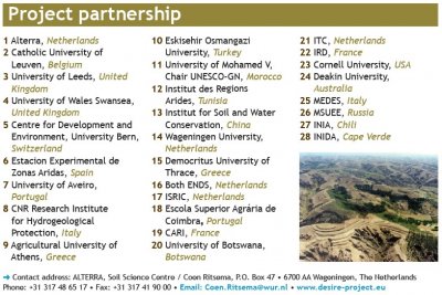
Guadalentin Basin, Murcia, Spain
Mação, Portugal
Rendina Basin, Basilicata, Italy
Crete, Greece
Nestos Basin, Maggana, Greece
Konya Karapinar Plain, Turkey
Eskisehir Plain, Turkey
Mamora/Sehoul, Morocco
Zeuss-Koutine, Tunisia
Djanybek, Russia
Novij, Saratov, Russia
Loess Plateau, China
Boteti Area, Botswana
Cointzio catchment, Mexico
Walnut Gulch Watershed, USA
Glenelg Hopkins region, Australia
Secano Interior, Chili
Santiago Island, Cape Verde
|
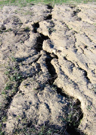
Drought, soil erosion by water
Forest fires
Soil erosion by water
Soil erosion by water, overgrazing, water stress
Salinisation
Soil erosion by wind
Soil erosion by water
Increasing pressure due to urbanization nearby
Competition for scarce water resources
Poor vegetation growth
Salinisation
Soil erosion by water and wind
Overgrazing and decreased flooding
Soil erosion by water
Vegetation change, flash floods
Salinisation, and sporadically bush fires
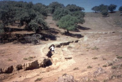
Soil erosion by water, extensive gullying
Soil erosion, drought, flash floods
|
 |
|
Download the brochure in English and other languages
|