|
Field measuring and monitoring methods |
 |
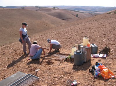 |
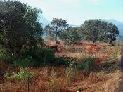
DESIRE implemented nearly 40 field experiments across all the study sites to assess the potential strategies that the stakeholders identified. To assist the design of these experiments a manual "Field measuring and monitoring methods for on-site effects of soil and water conservation measures" was compiled, giving an overview of currently available methods, techniques and instruments.
|
The manual draws (among others) on measuring and montoring methods developed or used in the LADA, WOCAT and MEDALUS projects.
Contents
1 Introduction to DESIRE Work block
1.1 Methodology
1.2 WOCAT and desertification processes
1.3 Indicators
1.4 Local indigenous indicators
2 General plot descriptions
2.1 Participatory impact monitoring
2.2 Description of the plot setting
2.3 General monitoring
2.4 A note on sample size
3 Monitoring of socio-economic indicators
3.1 Focus-group discussions on feasibility and acceptability (source: CDE)
3.2 Production in cropland (source: LADA local assessment manual)
3.3 Household level livelihoods analysis (source: LADA local assessment manual)
3.4 Farm management
3.5 Cost-benefit analysis
4 Meteorological measurements
4.1 Temporal resolution of meteo variables
4.2 Rainfall
4.3 Evapotranspiration
5 Soils and soil properties
5.1 Static quality indicators
5.2 Pedotransfer functions
5.3 Soil moisture monitoring
5.4 Infiltration
5.5 Soil Strength parameters |
6 Soil surface dynamics
6.1 General visual monitoring
6.2 Crusting dynamics
6.3 Roughness
6.4 Flow resistance
6.5 A combined soil surface index
7 Water erosion
7.1 Splash detachment
7.2 Flow detachment
7.3 Deposition
8 Runoff
8.1 Monitoring runoff
9 Vegetation properties
9.1 Processes
9.2 Sampling strategy
9.3 Canopy characteristics
9.4 Species composition and functional types
9.5 Biomass
9.6 Root depth and density
9.7 Litter, mulch and soil organic matter
10 Wind erosion
10.1 Monitoring wind erosion
10.2 Assessment of wind erosion
11 Salinity
11.1 Saline and sodic soils
11.2 Salinisation monitoring
12 Remote Sensing vegetation indices
12.1 Sensors and satellites
12.2 Vegetation, soil surface and drought indices |
|
 4. Implementing field trials