| PESERA-L: an addendum to simulate shallow mass movement |
 |
|
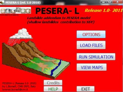
PESERA-L is an addendum to PESERA, modelling sediment yield due to shallow mass movment in a watershed. It was developed to simulate the shallow landslides which are the main land degradation problem in the Rendina study site.
PESERA-L operates (both input and output file) with common ASCII grid files (common ARCGIS, ASCII grid raster file format) and ASCII text file (CVS format) structured for an easy exchange with EXCEL spreadsheet. The software use a graphic rendering by help of GNUPLOT 4.4.2 graphic engine distributed as open source (GPL license) and redistributable wihin PESERA-L. In this way the input/output raster files can easily viewed, and exported directly by the program without more complex GIS software. A simple GUI front end allow an easy interaction with the user.
System requirements OS: windows XP,Vista,win7 ; Ram: 2GB; space on HD 100MB
|
|||||||||

Acknowledgement
The DESIRE project was
|
DESIRE brought together the expertise of
26 international research institutes
and non-governmental organisations.
This website does not necessarily
represent the opinion of the
European Commission. The European
Commission is not responsible for
any use that might be made of the
information contained herein. 


