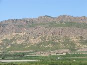
| Hillslope evolution in Tabernas badlands (SE Spain) since 1995. Erosion pins and laser scanner measurements |
 |
|
A. Afana (1), Y Cantón (2), and A Solé-Benet (1) (1) EEZA-CSIC, Desertification and GeoEcology, Almería, Spain, (2) University of Almería, Dept. Soil Science and Agricultural Chemistry, Almería, Spain
While soil erosion has been widely quantified at hillslope scale, advents in measurement techniques still provide new highlights on micro-topographical behaviour and effect on soil erosion and sedimentation. To know how erosion processes affect microtopography of two contrasted (aspect and plant cover) hillslopes in badlands in SE Spain, erosion pins and laser scanner monitoring techniques are being used since 1995. Historical records revealed that subjectivity and worker experience may introduce considerable uncertainties related to the form of measurements besides the continuous damage produced in the crusted microtopography. In a bare hillslope of SW aspect, 81 erosion pins have been monitored and measured annually till 2007 using a digital calliper and since 2008 with a Terrestrial Laser Scanner (TLS). In a sparsely vegetated, NE hillslope, 72 erosion pins are only measured with the digital calliper. Continuous, on-site meteorological data, provide precipitation magnitude and intensity. After 16 years of monitoring in NE hillslope only 2 mm of average sedimentation have been recorded though 21.47 mm of maximum erosion and 55 mm of deposition. However, in SW hillslope, where average erosion is recorded, maximum erosion has been 86 mm and maximum deposition 25 mm. At both hillslopes only a few erosion pins show significant relationships between their erosion or deposition values with either rainfall magnitude and maximum rainfall intensities from the measurement intervals. The rill or inter-rill position of every pin within each hillslope explains its specific and average behaviour with regards rainfall events: erosive, sedimentary or unvariable micro-topography. However, these specific behaviours seem to change at random along the years. Consequently prediction for single pins (or micro-topographical units) is not possible, but only for larger topographic units and after long-term records. These results confirm that in badlands the topographic behaviour at channel heads is unpredictable as can be controlled by complex local factors (micro-lithology and then micro-relief). Laser scanners avoid in-situ measurements of fragile environments and associated errors, though erosion pins are still an option where irregular patchy vegetation masks micro-topography.
|

Acknowledgement
The DESIRE project was
|
DESIRE brought together the expertise of
26 international research institutes
and non-governmental organisations.
This website does not necessarily
represent the opinion of the
European Commission. The European
Commission is not responsible for
any use that might be made of the
information contained herein. 
