General information
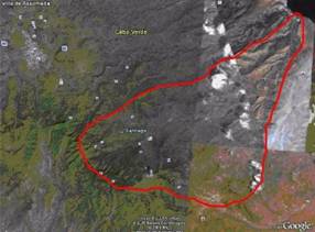
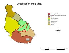
The study site is located in the Ribeira Seca catchment on the east side of the Santiago island, between 15º07'40''N and 15º01'55''N of Latitude, and the longitudes 23º32'05''W and 23º38'40''W (Figures 1 and 2). The study site covers an area of 71.50 km². The basin is characterized by an ecological gradient in the longitudinal direction assigned by the variation from the coastal precipitation to the top of Pico d´Antónia, located at 1394 m of altitude. The precipitation varies from 200 mm downstream to 650 mm at the upper limit of the basin. The maximum temperature is 28.1ºC and the minimum is 16.6ºC.
 |
 |
Figure 1: Catchment location |
Figure 2: Catchment location within the Santiago Island |
Main languages: Portuguese (official language), Crioulo (mother language).