Soils and water availability
The irrigated lands are located mainly on the right bank of the Volga River valley at one of five river corridor terraces. This territory is characterized by the most favourable soil and hydro-geological conditions and is suitable for irrigated farming (Fig. 5). Fertile automorphic chestnut soils have been formed on the terraces. As a rule, the ground water is fresh, slightly alkaline; sometimes it contains salts but their concentration is very low. The ground water table was mainly located at a depth of 5-7 m and deeper. The unsaturated zone has a two-layer structure: a low penetration upper layer (loamy soil) and a water bearing lower horizon (sand or loamy sand).

Fig. 5: Distribution across Saratov Region of a) soil type, b) ground type.
A thick layer of alluvial sediments (up to 40-60cm) contains a fresh water-bearing horizon. Therefore, the first industrial irrigation systems have been built here in the 1960s. In spite of the relatively high natural drainage, the development of irrigation has caused the groundwater table to rise and water-logging conditions on the adjacent areas. This was followed by dissolution of salt in the upper unsaturated ground layers and by a rise of ground water with higher salt concentrations into the root zone with a negative impact on soil fertility. Water-logging occurs first at the lower terraces above flood lands because of both infiltration of irrigation water and subsurface inflow from the upper terraces.
 |
 |
 |
 |
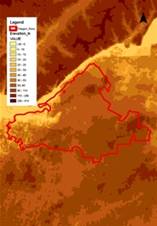
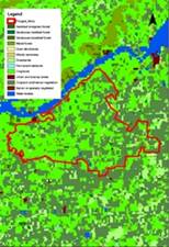
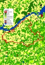
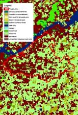
| Fig. 6: Regional Elevation map, derived from Global mapping | Fig. 7: Regional Land Cover map, derived from Global mapping | Fig. 8: Regional Land Use map, derived from Global mapping | Fig. 9: Regional Vegetation map, derived from Global mapping |