 |
Field monitoring programme
Authors: Institute of Soil and Water Conservation, CAS and MWR
|
Yan River is a first class branch of Yellow River, China. The average channel slope is 3.26%, and the area of whole basin is 7,687 km². The landscape is deeply gullied, with a gully density of 2.1 to 4.6 km·km-2. Annual average sediment delivery: 43.6 M tons; annual runoff: 142.5 M m3.
| Why monitor? |
 |
- To confirm the integrated impacts of different technologies and land use on natural resources.
- To test and explain the benefits of selected technologies from WOCAT-DESIRE process.
- To show the differences of technologies for the local farmers.
- To find something new, interesting and possible that has not been mentioned in the concern stages of DESIRE all the time.
|
| Who is monitoring? |
|
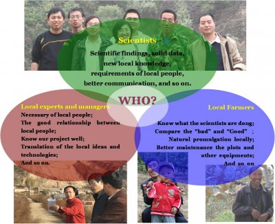
Scientists
- Scientific findings, solid data, new local knowledge, requirements of local people, better communication, ...
Local experts and managers
- Necessary of local people, the good relationship between local people, know the project well, translation of local ideas and technologies, ...
Local farmers
- Know what the scients are doing, compere the "bad" and "good", natural promulgation locally, better maintenance of the plots and other equipment, ...
|
|
Monitoring 1: Climate and weather conditions
|
|
|
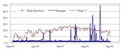
Two set of automatic weather stations (HOBO) are set up in Miaowan, Zhenwudong Town, Ansai country and Kelaigou Village, Liulin Town, Baota County. The result of precipitation, temperature, wind speed will be used in the soil moisture change and soil erosion evaluation. |
Monitoring 2: New soil erosion plots
|
 |
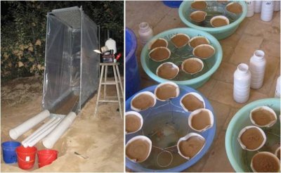 |
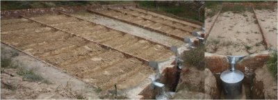
| Building erosion plots on the slope of orchard in Miaowan village (2 gradients ,13 and 29), 5 meters long, three treatments (natural slope without coverage, contour tillage and contour with mulching, two times) |
Some soil erosion tests with simulating rainfall finished. |
Monitoring 3: Small-scale rainwater harvesting
|
|
For improvement of dry and high climate change trends, small rainfall harvesting for deeper infiltration with plastic film in Miaowan Village are set and monitor the soil moisture and its impact on apple yield.
|

|
Montoring 4: Soil moisture measurements under different land uses
|
|

|
The cropland, orchards, grassland, shrub and forestry on different slopes or terraces are measured every two weeks with local farmers.
|
Monitoring 5: Crop and livelihood monitoring
|
|
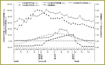
|
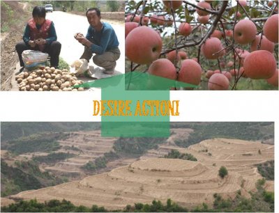
|
|

