| Prescribed fire: experimental results and conclusions |
 |
|
Like many Mediterranean countries Portugal suffers from forest fire due to its dry and hot climate. The problem is not only degradation of forest and the emission of carbon dioxide to the atmosphere but it also increases soil losses and pollution of water and air. The Vale Torto area near Góis in Portugal was burned by several fires in the 1970s and the early 1980s. Similarly the Camelo catchment near Góis also suffers from forest fire with the recent fire taking place in July 2008. In order to reduce soil losses caused by wild fire and to minimise the amount of flammable materials an experiment was applied which uses a technology called prescribed fire.
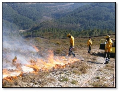
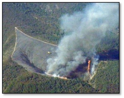
For studying the effect of wild fire and prescribed fire following data were used: Wild fire in Camelo study site (3.3 ha) in early summer 2008 comprising scrub vegetation representing a fuel load of 65 t/ha (Photo below left); Vale Torto, submitted to an experimental fire (9 ha) with a lower fuel load (23 t/ha) in February 2009 (Photo below right); Podentes subjected to a prescribed fire in April 2009. ln Podentes, the forestry service burned a smaller area (2 ha) comprising scrub vegetation on calcareous bedrock with fuel load of 70 t/ha. In Moinhos an area of 95 ha was burnt in September 2009 where eucalyptus were planted. To study the effect of forest fire, field study was carried out to collect data on soil moisture, infiltration, suspended sediments and nutrient contents. In addition to collecting data on soil, Vegetation recovery monitoring was also carried out using vertical-photography of plots of size 0.25m.
In addition, a lysimeter was also used to assess fire impact on soils started during 2010. During the experimental lysimeter fire flame temperature was assessed using an infrared heat sensor, that shows temperatures values of over 700ºC.
Studies carried out in the effects of ash in Podentes study site revealed that water repellence depends on plant species and to some extent also on slope aspect. The ash from A. Unedo shows major water repellence behaviour as compared to ash from other shrub species (Quercus coccifera, Pistacia lentiscus). Fire also influences soil infiltration. The study shows reduction of soil infiltration by about 25 per cent. Highest decline of infiltration capacity was observed in the burnt shrub species, A. unedo, which has also high soil water repellence value. This could be related to different surface litter and root systems of plant species. The results also show higher infiltration capacities on limestone area as compared to the area with schist bedrock. On schist sites, the fire had no discernible impact on runoff, and the average runoff coefficients for the burned sites were 24% Camelo, 29% Vale Torto and 8% Podentes. In case of soil losses, the schist study site shows a significant increase of soil loss for both cases: wild fire versus un-burned area (3.8 g m-² vs 0.1 g m-²), and prescribed fire versus un-burned area (1.6 g m-² vs 1.2 g m-²). In case of Vale Torto the increase in soil erosion after the fire was so significant. Soil loss results in Vale Torto site show a distinct increase (upto 8 -15 times) as compared to pre fire periods. In Camelo site, soil losses per unit contributing area are on average 1-2 orders of magnitude higher (2.2 t/ha for the first year after the wildfire, and 3.6 t/ha for the whole 19-month monitoring interval up to March 2010) compared with prescribed fire. The lysimeter data shows that the top soil (0-2cm depth) temperature during fire varied spatially, average temperature was around 250ºC, but in some places it reached 450ºC. At the sub-surface layer (2-5cm), soil temperature during the fire was around 60ºC which indicates that organic matter will be burnt only in the top 2 cm of soil.
|
||||||||||||||||||||
Study sites

Acknowledgement
The DESIRE project was
|
DESIRE brought together the expertise of
26 international research institutes
and non-governmental organisations.
This website does not necessarily
represent the opinion of the
European Commission. The European
Commission is not responsible for
any use that might be made of the
information contained herein. 


