Tillage direction
The soil can be tilled in various directions parallel or perpendicular to the contour lines or in oblique lines depending on the slope gradient, the farm size and farm shape. The various cultivation practices such as tillage direction, direction of furrow reversion, and plough depth have variable effect on soil displacement. By ploughing the soil at shallow depth in any direction of tillage operation, tillage erosion is significantly reduced. When the physiographic conditions allowed the movement of tractor along the contour lines, then soil displacement is highly restricted. Any other direction of tillage operation increases tillage erosion. If the plough layer is moved to the up slope position under any tillage operation, then soil displacement could be considered as an operation for restoring and conserving degraded hilly areas. In hilly areas with steep slopes, where contour farming is impossible, then the soil can be ploughed perpendicular or in oblique lines but ploughing the soil at shallow depth and moving preferably the plough layer to the up slope direction.
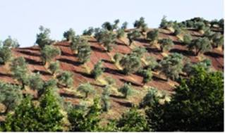
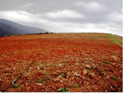
The following categories of tillage direction have been distinguished in this project: (a) downslope (Fig. 62), (b) upslope, (c) parallel to contour upslope furrow, (d) parallel to contour downslope furrow, (e) downslope oblique (Fig. 62), and (f) upslope oblique. Tillage direction has been defined by conducting the land owner or by identified in the field by observing the furrow lines.


Fig. 62. Ploughing the soil perpendicular to the contour lines (left) and in oblique line (right)
Data for this indicator have been collected in 1040 field sites, corresponding to 12 study sites (Table 8). As Table 9 shows, the dominant direction of ploughing in the study field sites was downslope, covering 19.2% of the total fields. This type of tillage direction causes the highest rates of soil displacement in hilly areas. Such type of tillage operation has been defined in the study sites of Secano Interior-Chile, Konya Karapinar plain-Turkey, Mamora Sehoul-Morocco, Eskisehir-Turkey, Zeuss Koutine-Tunisia, Guadalentin Basin Murcia-Spain, and Crete-Greece. The next important tillage direction defined was parallel to the contour line with up-slope reversion of furrow, covering 11.1% of the study fields, and corresponding to some cases in the study sites of Secano Interior-Chile, Santiago Island-Cape Verde, Mamora Sehoul-Morocco, Guadalentin Basin Murcia-Spain, Crete-Greece, and Loess Plateau-China. The next important tillage direction was parallel to contour lines with down-slope reversion of furrow, covering 6.5% of the study fields, corresponding to the study sites of Secano Interior-Chile, Rendina Basin Basilicata-Italy, Boteti Area-Botswana, Mamora Sehoul-Morocco, Zeuss Koutine-Tunisia, and Guadalentin Basin Murcia-Spain. Downslope ploughing in oblique direction has been found in 8.2% of the study field sites, corresponding to the study sites of Rendina Basin Basilicata-Italy, Zeuss Koutine-Tunisia, Guadalentin Basin Murcia-Spain, Cointzio Catchment-Mexico, and Crete-Greece. Upslope or upslope oblique tillage direction has been defined in few cases (0.3%, and 3.2% of the study sites), corresponding to the study sites of Secano Interior-Chile, Rendina Basin Basilicata-Italy, Novij Saratov-Russia, and Loess Plateau-China. Finally, no tillage has been defined in half of the study field sites (51.5%) (Table 8b), corresponding to the study sites of Rendina Basin Basilicata-Italy, Boteti Area-Botswana, Santiago Island-Cape Verde, Mamora Sehoul-Morocco, Guadalentin Basin Murcia-Spain, Loess Plateau-China, and Crete-Greece.
Table 8b. Distribution of tillage directions defined in the study field sites
| a/a | Tillage direction | Frequency of appearance (%) |
| 1 | downslope | 19.2 |
| 2 | upslope | 0.3 |
| 3 | parallel to contour, up-slope furrow | 11.1 |
| 4 | parallel to contour, down-slope furrow | 6.5 |
| 5 | downslope oblique | 8.2 |
| 6 | upslope oblique | 3.2 |
| 7 | no tillage | 51.5 |