Irrigation percentage of arable land
This indicator defines the land area under irrigation as a percentage of total arable land. In addition irrigation percentage of arable land defines the extent in which arable land and water resources are intensively used. Areas with adequate amount of good quality of water available for irrigation are subjected to lower desertification risk. Because the expected warmer and drier climate accompanied with increase in aridity and drought hazard, the extension of irrigation will be necessary over large areas for efficient agricultural production and protection of the environment. The expansion of irrigated land will probably aggravate the existing problem of brackish water intrusion in aquifers through diminishing groundwater recharge or reduced amount of rainfall. The sustainable use of water resources and the appropriate land management systems and land management practices will be the appropriate tools for combating desertification in those areas. The following classes of irrigation percentage of arable land (IP) have been distinguished in this project: (a) very low, IP<5% of the total area is irrigated; (b) low, IP=5-10% of the total area is irrigated; (c) moderate, IP=10-25% of the total area is irrigated; (d) high, IP=25-50% of the total area is irrigated; and (e) very high,IP >50% of the total area is irrigated.


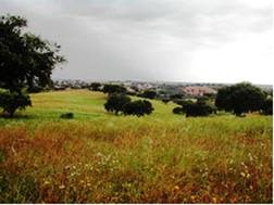
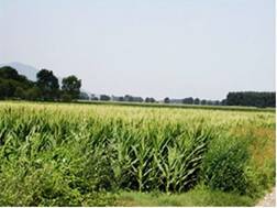
Fig. 88. Non-irrigated land under moderate desertification risks (left) and irrigated land with good quality of water under low desertification risk (right)
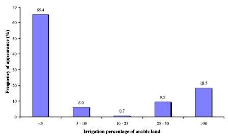
As Table 12 shows, irrigation percentage of arable land has been defined in 1169 field sites, corresponding to 12 study sites. The analysis of the data shows that 65.4% of the study field sites are located in areas in which less than 5% of the surrounding land is irrigated (Fig. 89). Such field sites have been found in all cases of the study sites of Boteti Area-Botswana, Secano Interior-Chile, Guadalentin Basin Murcia-Spain, Mamora Sehoul-Morocco, and Djanybek-Russia, and in some cases in the study sites of Cointzio Catchment-Mexico, Novij Saratov-Russia, Santiago Island-Cape Verde, Zeuss Koutine-Tunisia, and Crete-Greece. The next important class of irrigation was >50% of the total arable land irrigated, covering 18.5% of the total study field sites. Such field sites have been found in the study sites of Novij Saratov-Russia, Nestos Basin Maggana-Greece, Santiago Island-Cape Verde, and Crete-Greece. Percentage irrigated arable land in the class 25-50% has been defined in 9.5% of the study sites, corresponding to the study sites of Crete-Greece. The class 5-10% of the arable irrigated has been defined in 6.0% of the study field sites, corresponding to study sites of Novij Saratov-Russia, Zeuss Koutine-Tunisia, and Santiago Island-Cape Verde.

Fig. 89. Distribution of irrigation percentage classes of arable land defined in the study field sites