|
Author: Victor Jetten
Introduction
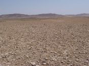
In the Guadalentín basin in south-eastern Spain, land degradation is considered severe due to a combination of several factors. The semi-arid climate has dry summers followed by intense autumn rainfall, while there is a steep topography and fragile soils. Desertification takes the form of soil erosion and drought. Moreover, considerable land use changes have taken place over the last centuries, which is an important driving force for further degradation in the area. Different conservation techniques used are: water harvesting with irrigation by captured runoff water, minimum tillage, mulch and green manure.
The most dominant soil types in the Torrealvilla study area are Regosols, Fluvisols, Calcisols, Gypsisols and Leptosols (FAO, 2006). The experimental plots are located on Calcisols and Regosols under relatively gentle to moderate slopes between 5 and 15 %. The climate is semi-arid with a mean annual rainfall around 300 mm. Droughts, centered in summer commonly last for more than 4-5 months. Annual potential evapotranspiration rates larger than 1000 mm are common.
Desertification indices
The index was calculated for water erosion, tillage erosion and water stress. A single set of values is selected and the conservation techniques are implemented as good as possible, selecting a combination of variables related to the technologies. A distinction is made for almonds that grow as separated bushes with bare soil in between, and cereals which have a denser seasonal cover. The almonds grow on terraces, while the cereals are on gently sloping terrain.
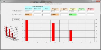
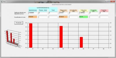
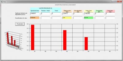
Generally water erosion is identified as a moderate risk followed by tillage erosion (moderate) and water stress (no risk).
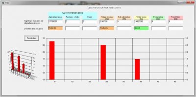
- Almonds and water harvesting: water harvesting cannot really be implemented except as runoff control which slightly decreases the water erosion, also the fields are on terraced land. Water stress is not identified as a problem. The experiment showed that water harvesting was a success in terms of yield increase although the effect on desertification was not very direct. From that point of view the assessment tool is correct.
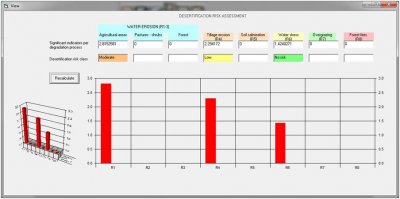
- Almonds and reduced tillage: the tool shows a clear effect and water and tillage erosion reduce to low risk (in line with reality). Note that minimum tillage ignores the ploughing setting, so tillage operations have to be set to “no ploughing”.
- Almonds and green manure (green cover) is parameterized as sustainable farming “inducing cover” and soil erosion control measures with an increase of cover to “adequate 75%”. Oddly enough this does not influence water erosion which is comparable to the unmitigated situation. This is not according to reality.
- Cereals and minimum tillage: similar to Almonds and minimumtillage. The plant cover does not sem to have an effect on the water erosion: a cover of < 25% or >75% does not generate a difference.
 |
 |
| Unmitigated situation, almonds |
Almonds and water harvesting |
 |
 |
| Almonds and minimum tillage |
Almonds and green manure/cover |
 |
|
| Cereals and minimum tillage |
|
Conclusions
The assessment tool does not permit very well the inclusion of conservation measures implemented in Spain. Clear reductions in runoff measured for minimum tillage and green cover under almonds were only shown as a slight decrease in risk. The overall picture is correct but the effect of the technologies seems minimal. Water stress is not identified while this is generally a problem in the area. Interestingly tillage erosion is seen as a moderate hazard which could be an indication for further research.
Certain variables are not linked: minimum tillage can be selected with ploughing as a tillage operation which will then ignore minimum tillage. A soil cover does not seem to have an effect on water erosion.
|

