| Evaluating the desertification risk assessment tool with local experimental results |
 |
|
Author: Victor Jetten
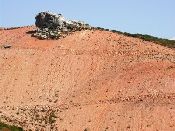
Introduction The Zeuss Koutine area in Tunisia suffers from over exploitation of the aquifers, and extension of orchard cultivation at the expense of natural grazing lands. Severe long drought periods reduce soil water content to levels where olive plantation can suffer enormously. Traditional water harvesting techniques (Jessour and Tabias) are used for the improvement of water content of soil. Replenishment of groundwater aquifers are ensured through the recharge structures (gabion check dams and recharge wells). However, current cropping levels versus water availability may not be sustainable. The experiments are geared towards monitoring water levels, as the water harvesting techniques are well established. Moreover, ever since the ground water has been exploited by means of drilling a lot of pastoral land was converted into irrigated cropland or orchard. This has increased the pressure on the remaining land causing over grazing and associated soil erosion problem. An experiment was carried out to improve plant cover and biodiversity in the grazing areas aiming at minimizing land degradation.
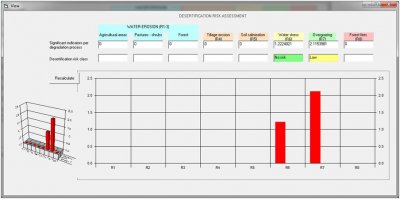
Desertification indices
Conclusions The desertification risk assessment tool is not well equipped to deal with water stress in this very dry area. The factors leading to water stress are statistically chosen which creates some strange omissions (e.g. rainfall amount is not a factor in water stress). The grassland improvement is better simulated with an increase in cover as a result of rangeland resting.
|
Study sites

Acknowledgement
The DESIRE project was
|
DESIRE brought together the expertise of
26 international research institutes
and non-governmental organisations.
This website does not necessarily
represent the opinion of the
European Commission. The European
Commission is not responsible for
any use that might be made of the
information contained herein. 


