|
Evaluating the desertification risk assessment tool with local experimental results |
 |
|
Author: Victor Jetten
Introduction
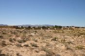
The Dzhanibek study area is situated on the territory of Pallasovsky District, Volgograd Region, which is a dry steppe area situated at the left bank of lower part of Volga River valley. The climate of has a number of negative characteristics (drought, dry hot winds, dust whirls etc.) but also positive factors as warm summers and high radiation allows the valuable agricultural cultivation. The irrigation of crops in this region (situated at about 100 km from Volga River and very scarce local resources of fresh water) was stopped in early 2000 due to increasing of costs for water delivering strongly linked to high price for energy. Working equipment was sold, the old units finally broke down. Water storage capacities at the territory were absolutely dry for already 4 years from beginning of project activities. Before, they were used to be filled with snowmelt water. Unprofessional vegetable farming for domestic use is also under threat. High evaporation and shallow groundwater lead to salinization of the soil. Nowadays the main income of the stakeholders is agricultural production from their garden plots (fruits and vegetables), growing cattle (sheep and cows). There is a big agricultural conglomeration – farm “Romashkovsky”. The young generation is leaving rural areas due to level of life and possibilities to find more income in the urban area. Lack of information about sustainable land management, climate instabilities and weak institutional support with low financial support from the government makes the life of people in this region difficult. The experiment focusses on testing drip irrigation as a water conservation practice while generating a viable crop yield.
Desertification indices
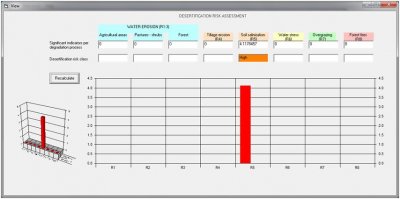
The main desertification process is salinization. The risk is calculated as very high (4.56) because the annual precipitation is low (400 mm) the evaporation is much higher and irrigation water is from partly saline groundwater. When drip irrigation is simulated with partly fresh water and assumed this causes a reduction of overexploitation of groundwater to local pockets, the salinization risk drops to moderate (3.41). This depends also on the drainage of the soil, in places which are well drained the risk is moderate (3.29) and very poorly drained soils still have a high risk (3.70).

Conclusions
The desertification risk assessment tool deals relatively well with the actual situation and the proposed technology (drip irrigation with fresh water), because this can be translated in variables that occur in the system.
|


