Main land uses
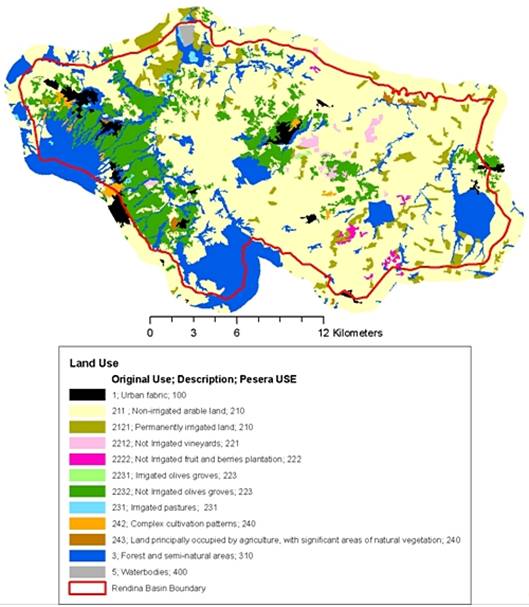
The main land uses are:
- arable lands,(60%)
- herbaceus crops,(4%)
- urban areas (2%)
- olive-groves (13%)
- vineyards(1%)
- uncultivated land, permanent meadow, shrubby natural vegetation (3%)
- woodlands dominated by chestnut tree, pasture (very steep surfaces), woodlands dominated by deciduous forest (oaks). (16%)
- others (2%)

Figure 10: Land use map of Rendina Basin

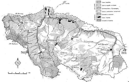
Figure 11: Historical land use map 1963 (by Cotecchia and Lonoce, 1963) Legend: Zone boschive (woodlands); Zone a vigneto e oliveto (Vineyard and olivejards); sietemazioni a gira poggio (terraces); zona a seminativo cerelicolo (arable land - cereals); eroisone e calanchi (intense erosion processes and calanchi (badlands)); zone franose( landslides); erosione di sponda (river bank erosion)