General Information
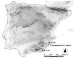
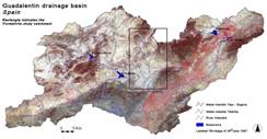
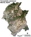
Given the severity of the problem in the Guadalentín basin and taking advantage of the long history of research projects, the Guadalentín was selected as the Spanish study area in the DESIRE project. The focus of most research within DESIRE will be on the sub-catchment of the 'Rambla de Torrealvilla', which is considered to be representative for large parts of the Guadalentín basin. See Figures 1, 2 and 3 for the location and an image of the Guadalentín basin and the Torrealvilla catchment. The Guadalentín basin covers an area of about 3300 km² (see Figure 1 and 2). The 'Rambla de Torrealvilla' is a tributary in the headwaters of the Guadalentín upstream of Lorca, and covers about 250 km² (Figure 3).
During the last two decades, the drainage basin of the Guadalentín in south-eastern Spain has been the study area for many studies dealing with land degradation. Examples are the projects MEDALUS, DESERTLINKS, MEDACTION, and RECONDES funded by the EU, but also various Spanish national research projects have focused on parts of the Guadalentín basin. One of the reasons for the broad interest in the Guadalentín basin is that land degradation is generally considered severe in large parts of the basin due to a combination of the Mediterranean climate, characterised by dry summers followed by intense autumn rainfall, an often steep topography with fragile soils on highly erodible lithologies. Moreover, initiated by political and socioeconomic changes, important land use changes have taken place over the last centuries, which have formed an important driver for further land degradation in the Guadalentín basin.
Soil erosion by rills and gullies forms one of the main causes of land degradation in the Guadalentín. Apart from the natural conditions favouring soil erosion (i.e. topography, climate and lithology), high soil erosion rates are often triggered by frequent tillage, uncontrolled land abandonment and improper reforestation techniques. Another land degradation problem is soil salinization due to overexploitation of aquifers. Measures to combat land degradation problems have been applied for over 100 years. Some of them have been successful, while others have failed.


