Previous assessments of erosion rates and land degradation
Field measurements and mapping
Excessive runoff and consequent soil erosion are two of the main drivers of land degradation in Mediterranean environments (Poesen and Hooke, 1997), and therefore, many studies have focussed on the assessment of runoff generation and soil erosion rates under different soil and land cover conditions.
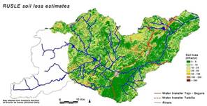
In various research projects erosion rates have been measured, relations between erosion, soil, plant and climate characteristics have been studied, and ephemeral streams have been monitored and modelled (see Figure 10 for references). At a national level, in 2002 the Ministry of Environment (DGCONA) initiated a national inventory of soil erosion (INES) to locate, quantify and analyse the evolution of erosion processes in Spain. In every province an inventory and map (1:50,000 scale) will be made of rill, gully, river bank and wind erosion and mass movements. The inventory maps of the province of Murcia have been completed. The inventory will be repeated on a cyclical basis.
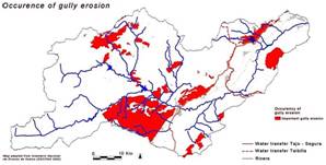
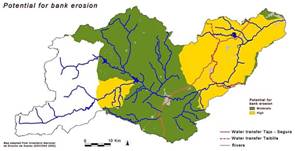
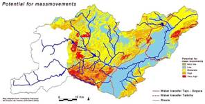
Figure 11: Erosion assessments for the Guadalentín basin based on the Inventario Nacional de Erosion de Suelos (DGCONA, 2002). Data are only available for the Murcia region. Other regions (i.e. Almeria) are expected to follow soon.
Figure 11 shows 4 of the INES erosion maps for the Guadalentín basin. An important improvement of the INES erosion assessments compared to previous erosion assessments like the ICONA soil erosion maps of the 1980s (ICONA, 1988), is that for the first time erosion from gully and bank erosion and mass movements are taken into consideration. Various studies on soil loss due to gully erosion in semiarid environments indicated towards high contributions of gully erosion to total sediment yield at the basin scale (e.g. Faulkner, 1996; Wasson et al., 1998; Casali et al., 1999; Oostwoud Wijdenes et al., 2000; Wasson and Claussen, 2002; Poesen et al., 2003). Gully erosion in the Guadalentín was estimated to produce about 3760 t/km2/yr, which according to Poesen et al (2002) is equivalent to about 51% of total soil loss due to rill, interrill and gully erosion. Likewise, a study of Cs137 concentration in the sediments retained by the Puentes reservoir indicated that about 60% of the sediments have a subsurface origin, pointing towards an important contribution of gully and bank erosion processes (Plata-Bedmar et al., 1997).
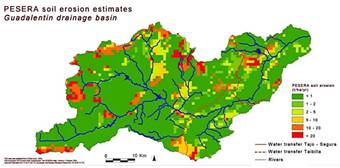
For comparison, Figure 12 shows the PESERA erosion estimate for the Guadalentín, as was extracted from the PESERA European erosion assessment at a spatial resolution of 1 km (Kirkby et al., 2004). Within DESIRE a revised application of PESERA with higher resolution input data is foreseen.
Figure 12: Soil erosion assessments for the Guadalentín basin extracted from the PESERA soil erosion map of Europe (Kirkby et al., 2004).
